As the United Kingdom braces for its third named storm of the season, residents are urged to prepare for potentially severe weather caused by Storm Conall. This incoming storm is expected to deliver heavy rain and high winds to southern England, further complicating the aftermath of Storm Bert, which recently wreaked havoc on local communities. The regularity with which these storms have developed raises concerns not only about immediate weather disruptions but also about the broader implications of climate change and its effects on the UK’s weather systems.
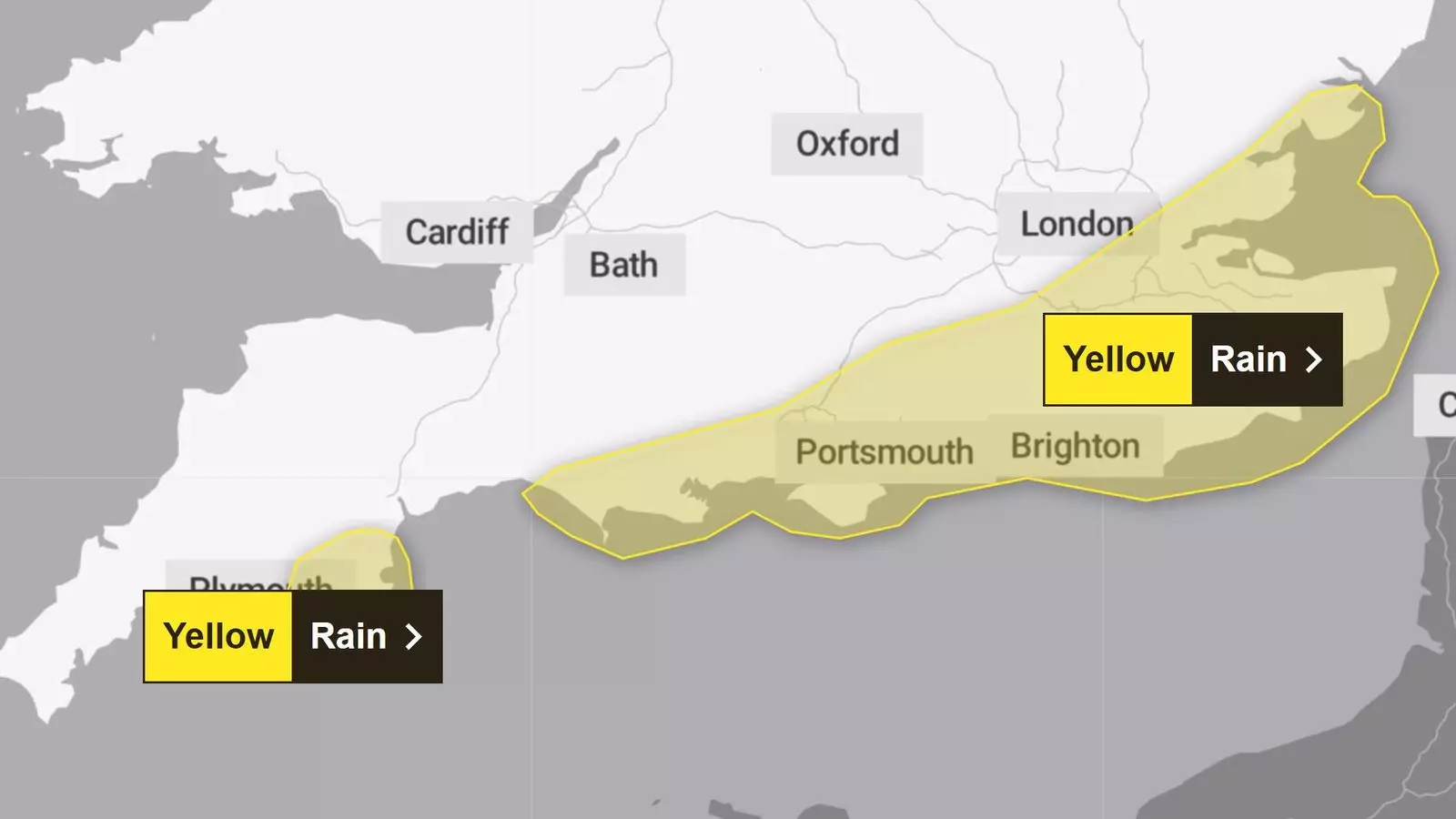
The Dutch weather service KNMI has categorized this system as a significant storm due to the persistent pressure instability it brings along its path. As an indication of its severity, forecasts suggest that some areas may receive upwards of 50mm of rain through the night. Many communities in southern counties, including Kent, Sussex, and the Isle of Wight, have been designated under a Met Office yellow rain warning, alerting citizens to the potential for travel disruptions and local flooding. The extent of rainfall may extend the challenges faced by homeowners and businesses still recovering from Storm Bert’s recent impact, where extensive rainfall resulted in roadway flooding and significant property damage.
The Environment Agency’s Chris Wilding has indicated there may be “significant flooding impacts” in Northamptonshire, where the region is still vulnerable from recent weather events. The River Severn is expected to experience minor flooding, providing an additional layer of concern for local inhabitants. Areas in Essex, Surrey, Hampshire, and parts of London can similarly expect adverse conditions, with rainfall contributing to the potential for surface flooding and extended travel issues.
The situation is compounded by a series of flood warnings and alerts already established across the UK; numbers are staggering, with over 90 flood warnings and more than 120 flood alerts issued as of Tuesday evening. Notably, a severe flood warning indicating danger to life is currently active in areas surrounding the River Nene in Northampton, underscoring the need for heightened vigilance and preparedness among the affected populations.
Communities across the affected regions have been adopting resilience measures in response to this recurrent weather phenomenon. Cleanup efforts are still underway following the recent disruptions caused by Storm Bert. Important lessons can be learned from the responses to past storms, including improved infrastructure and better emergency planning. With the continued frequency of named storms, adaptive strategies must become an integral part of local governance and community planning.
Moreover, communication between the KNMI, the UK’s Met Office, and Ireland’s Met Eireann facilitates a timely and organized reaction to these adverse weather events. By sharing information and issuing warnings cooperatively, these meteorological agencies can help ensure that communities take preemptive actions and reduce the potential for loss of life and significant property damage.
As the season progresses, residents must remain alert to the possibility of further storms, especially with the unpredictable nature of weather patterns amplified by climate change. The frequency of these storms suggests an urgent need to understand and address the underlying causes, including the effects of global warming. The storm naming system, which has been in effect since 2015, aims not just to inform but to reinforce the importance of preparing for severe weather. This ongoing initiative could enhance public awareness and encourage proactive measures for future incidents.
As Storm Conall approaches, it is vital for communities to be prepared for another bout of significant weather. This storm serves as a reminder of the challenges posed by nature’s unpredictability and the necessity for ongoing vigilance and adaptability in the face of increasing climatic threats.


Leave a Reply