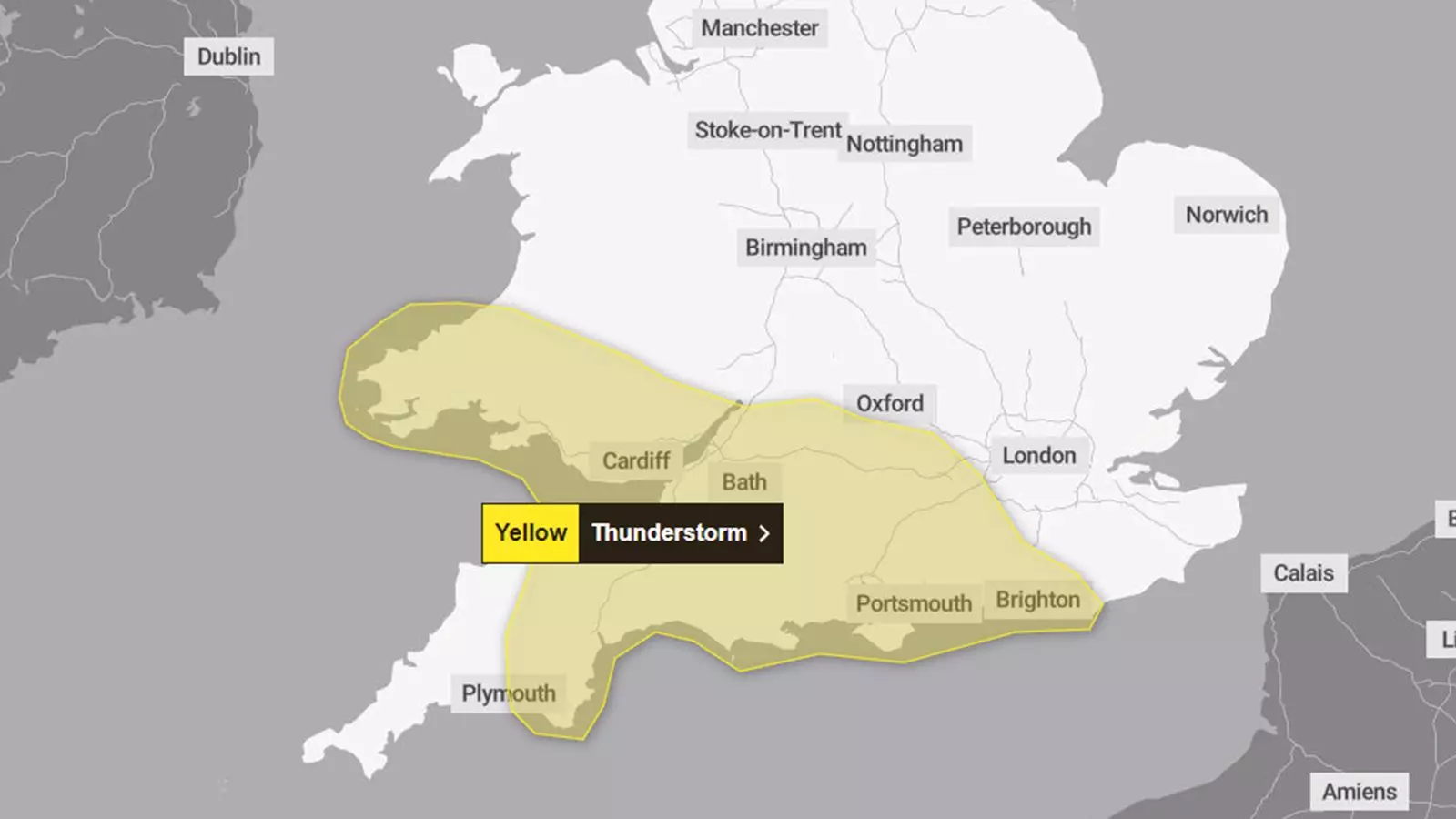
The UK’s meteorological landscape is poised for significant disruptions as forecasters predict thunderstorms and torrential rainfall later today. The Met Office has issued a yellow weather warning that will be in effect from 4 PM to midnight, affecting large swathes of South Wales, South West England, and the southern parts of England. Predictive models suggest that localized areas could experience an alarming accumulation of rain, with forecasts estimating up to 40mm could fall within a short window of two to three hours. This imminent situation requires careful preparation and awareness, as it presents the risk of flooding, travel interruptions, and potential power outages.
As the storms make their way across the region, the repercussions are likely to be felt in various aspects of daily life. Motorists should expect hazardous driving conditions; water accumulation, spray from the road, and even hail could significantly impact visibility and maneuverability. Train services are also at high risk of disruptions, adding to the woes of commuters. The Met Office explicitly warns of the potential for flooding, which could infiltrate homes and businesses, leading to property damage and the inevitable challenges of recovery afterward. Furthermore, interruptions to electric supply are a distinct possibility, leading to a significant inconvenience for residents.
According to meteorological experts, the regions most at risk are predominantly south-facing coastal areas, which are commonly more susceptible to extreme weather phenomena. This observation aligns with previous weather patterns observed during similar storms, establishing a clear link between geography and storm impact. As the thunderstorms roll in, the coalescence of heavy rainfall, accompanied by strong winds and frequent hail, amplifies the potential for severe weather events. The public is encouraged to remain vigilant, particularly those residing in vulnerable areas, who should prepare for emergency protocols should conditions worsen.
Adding an unprecedented layer to this weather event is the influence of ex-Hurricane Kirk, which is forecasted to glide south of the UK, delivering heavy rains and vigorous winds to northern France instead. This shifting weather pattern reflects the complexities of environmental changes, where storms can suddenly alter the expected course. Although the threat of Kirk directly impacting the UK appears diminished, it serves as a stark reminder of how interconnected weather systems can be, and the unpredictability that accompanies them.
In addition to the immediate storm threats, temperature plummets are anticipated. Starting Wednesday, northern regions of the UK can expect a dip below average, with nighttime frosts likely affecting various areas later in the week. Higher elevations in Scotland may even see snow, thus introducing another level of caution for those in travel and outdoor pursuits. The general consensus among meteorologists is that such erratic weather, with fluctuations from rainstorms to frost, will be increasingly common.
The yellow weather warning issued by the Met Office serves as an urgent call to both citizens and local authorities to prepare for potential challenges ahead. While such warnings indicate a likelihood of manageable impacts, there remains the potential for severe weather events that can escalate quickly. Residents are urged to stay informed through reliable channels and consider proactive measures to safeguard life and property. It is a time to reflect on the implications of rapidly changing weather conditions and to cultivate resilience within communities facing potential hardships. As the storm develops, vigilance and preparation will be key in navigating the uncertainties that lie ahead.


Leave a Reply